Lands Design – BIM Technology for 2D Technical Drawings and 3D Modelling for Landscape Design
Help you in creating 2D and 3D presentations providing a realistic view of how exactly your landscape will look like after construction.
Try it out now to experience this extremely user-friendly and dynamic landscape design software.
Use all CAD and drafting tools required to produce 2D/3D architectural drawings, construction details and any kind of annotations.
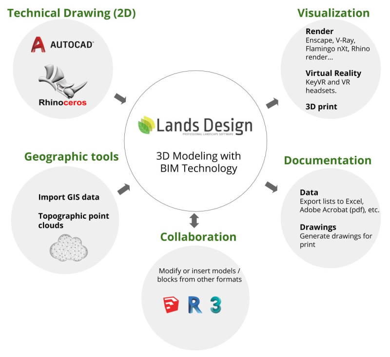
Create terrains from contours, elevation curves or point clouds. Terrains can be also imported from the web. Lands includes tools to modify terrains.
Hardscape refers to the solid, hard elements in landscape design that stay the same for years. Retaining walls, fences, stairs and driveways.
Lands provides a plant database with more than 8000 species, with technical specifications, detail characteristics and customizable display modes in 3D and 2D.
It provides instruments to design your irrigation system by a network of pipes, outlets and customized components that can be scheduled.
Generate setting out 2D plans from the 3D model, plant schedules, areas, irrigation plans, labels, automatic dimensions.
Get real images to show to your clients, from Lands Design or through some render engine. Virtual tours and walk mode available.
Lands Design works with the Grasshopper visual programming language.
Software designed to help people involved in a common task to achieve their goals.
Lands Design licenses are perpetual, can be used as floating licenses, and are available for academics at a reduced price.
Lands Design works on top of Rhino and AutoCAD and takes advantage of all their features to complete all stages of a landscape project.
© Copyright 2024 by Forida Limited